Tour du Mont Blanc in 7 days 🇫🇷🇮🇹🇨🇭

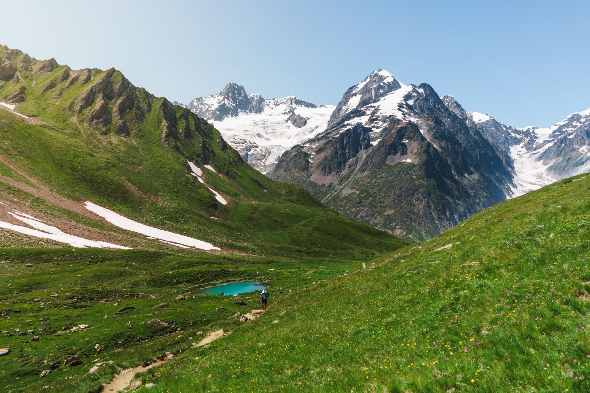
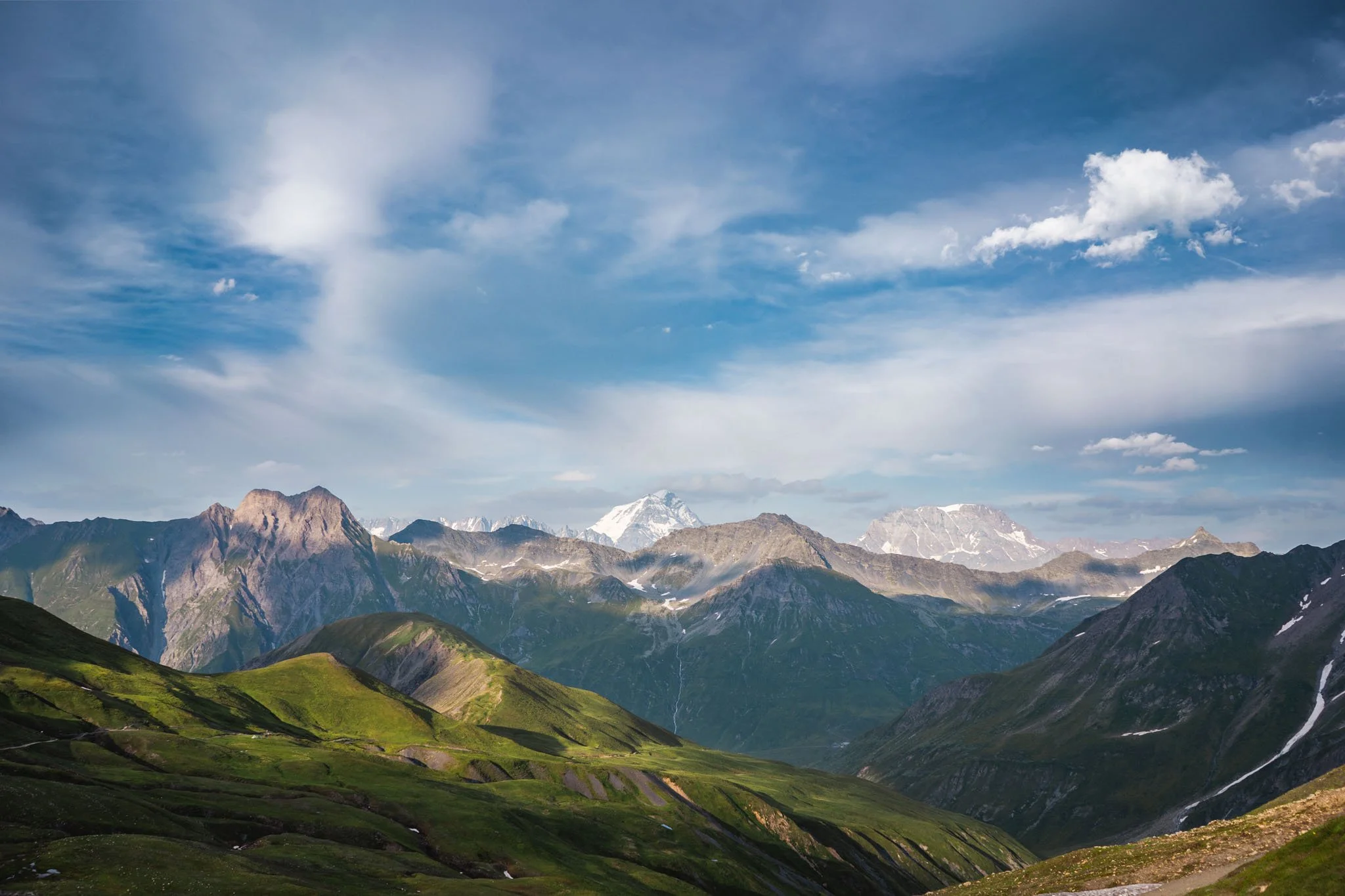
South face of Mont Blanc, along with its disappearing glaciers as seen from the other side of Val Veny in Aosta Valley, Italy
It was the 18th of July 2021, two days after I proposed to my then-to-be wife, Veronika. Veronika, her brother Marek and I had our bags packed, and we drove 6 hours from Luxembourg to the renowned ski town Chamonix, the mecca of mountaineering. Let me take you on a 7-day expedition in the Alps through the photographs I took with my camera and phone.
Day 1 - Les Houches to Camping le Pontet | 21KM, 1000M 🔺
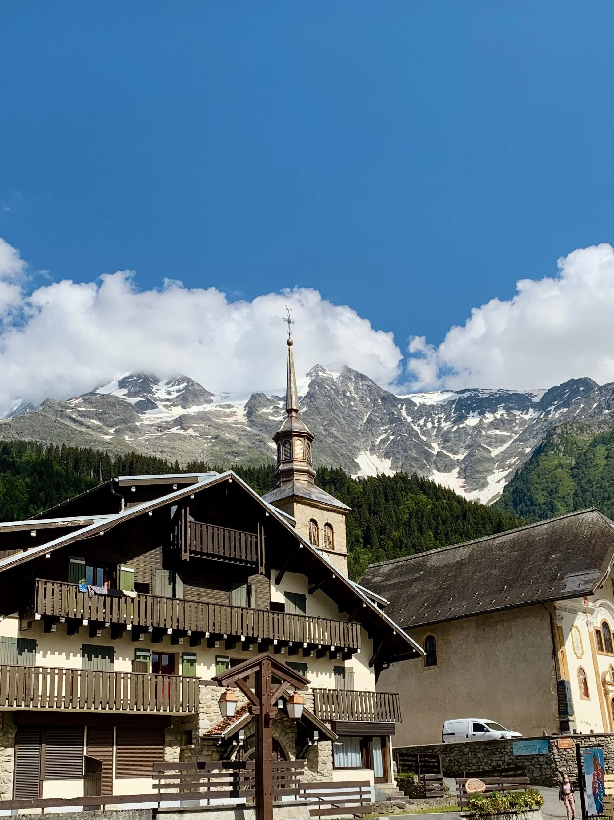
The first day of TMB began with a 900M uphill climb that took us above Les Houches. The trail mainly went through the dense woods, which protected us from the sun. After we crossed the first pass of TMB, Col de Voza, the trail took us through numerous alpine villages, and we finally ended our day in Camping le Pontet where we set up our camp for the night.


Stats and route
Day 2 - Camping le Pontet to Les Chapieux, 20KM| 1300M 🔺
On our second day, we crossed the first significant pass on the trail at ~2450M, Col du Bonhomme. This section of the course was much wilder than yesterday. There were no alpine villages on the way, just mountains around us with minimal infrastructure. There was still some human footprint to be seen, but it was nowhere as grown as yesterday’s route.
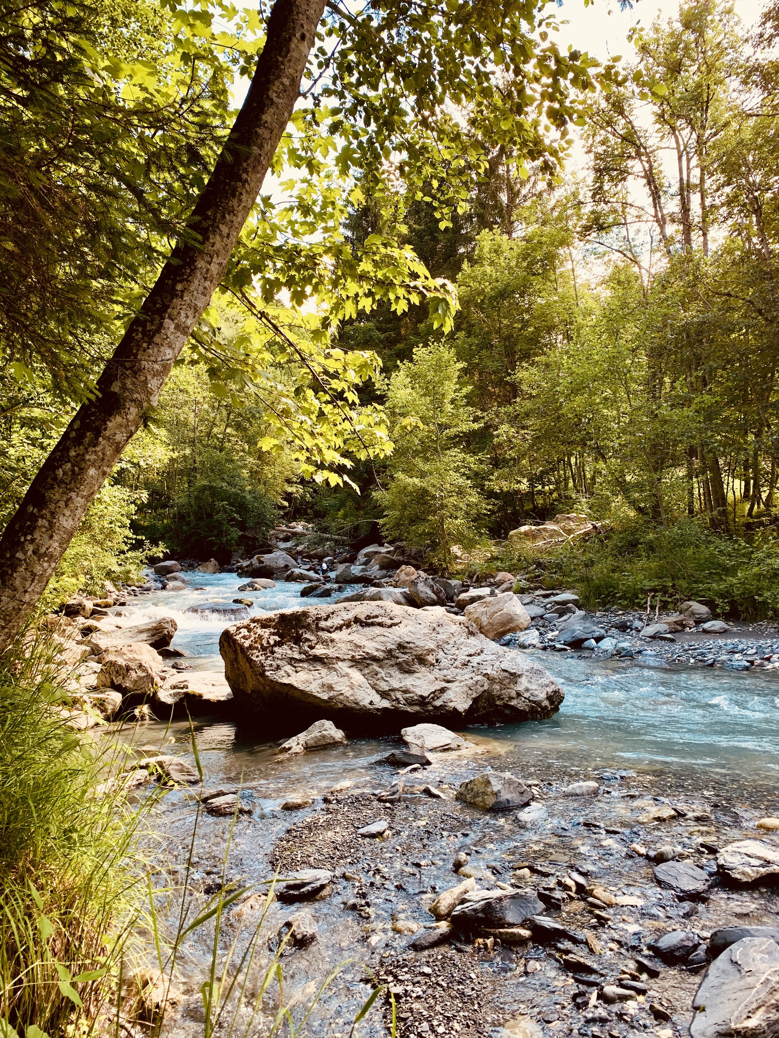
We ended the day in a settlement called Les Chapieux, one of the most remote hamlets I have ever been to. The campsite for the night was next to a massive blue glacial river which was perfect for washing ourselves after a long day. It was such a tranquil feeling to bathe in an ice-cold river (Torrent des Glaciers) surrounded by mountains and wildlife. There was no phone service in this valley. The whole evening was just about the essential elements of life. We fell asleep to cowbells and the thundering sounds of the river.


Stats and route
Day 3 - Les Chapieux to Courmayeur, 33KM| 1400M 🔺
We eventually left France behind and crossed into Aosta Valley, Italy. Col de la Seigne was the highest point of the day at 2516M, serving as the border between France and Italy. Today’s section went through some of the most outlying parts of the whole trail. At some spots, there was no human footprint to be seen. It was also one of the more demanding days on the trail with two significant climbs and a whopping 1200M steep descent down to the famous ski town Courmayeur to end the day with. After three days of slogging, we wanted to reward ourselves; therefore, we booked a hotel in Courmayeur for a nice hot shower and comfy beds for the night.


Stats and route
Day 4 - Courmayeur to La Fouly| 34KM, 2000M 🔺
I did not know what to expect from this day. In our plans, we were supposed to cover the rest of the Italian section of the hike today, climb the highest mountain pass on TMB, Grand Col Ferret, at 2537 meters, and plunge 1600 meters into Switzerland. It did not sound like a substantial deal on paper. We covered a comparable distance yesterday.
The day started with a stroll through the town of Courmayeur. We pondered how it must be to live in a ski town like this one, with mountains all around you. As soon as we were out of town, the day's first ascent picked up with a total of 800m elevation gain that led us to Rifugio Giorgio Bertone. This was the most congested section of the hike on all of TMB, with a long snake-like line of people end-to-end. This was followed by a flat balcony-like trail with gorgeous views of the Mont blanc massif to the left until we reached Rifugio Walter Bonatti.
At the hut, we ended up conversing with a Belgian couple who stayed at the same hotel as us in Courmayeur and was hiking TMB. When we told them of our plan to reach La Fouly, Switzerland, they thought we were crazy. We didn’t think much of it and started the last and most anticipated section of the hike, a significant climb to the famous mountain pass of Grand Col Ferret, where Italy meets Switzerland. It was around 16h, so pretty late in the day to be doing another 800m of climb and then 1600m of descent into Switzerland.
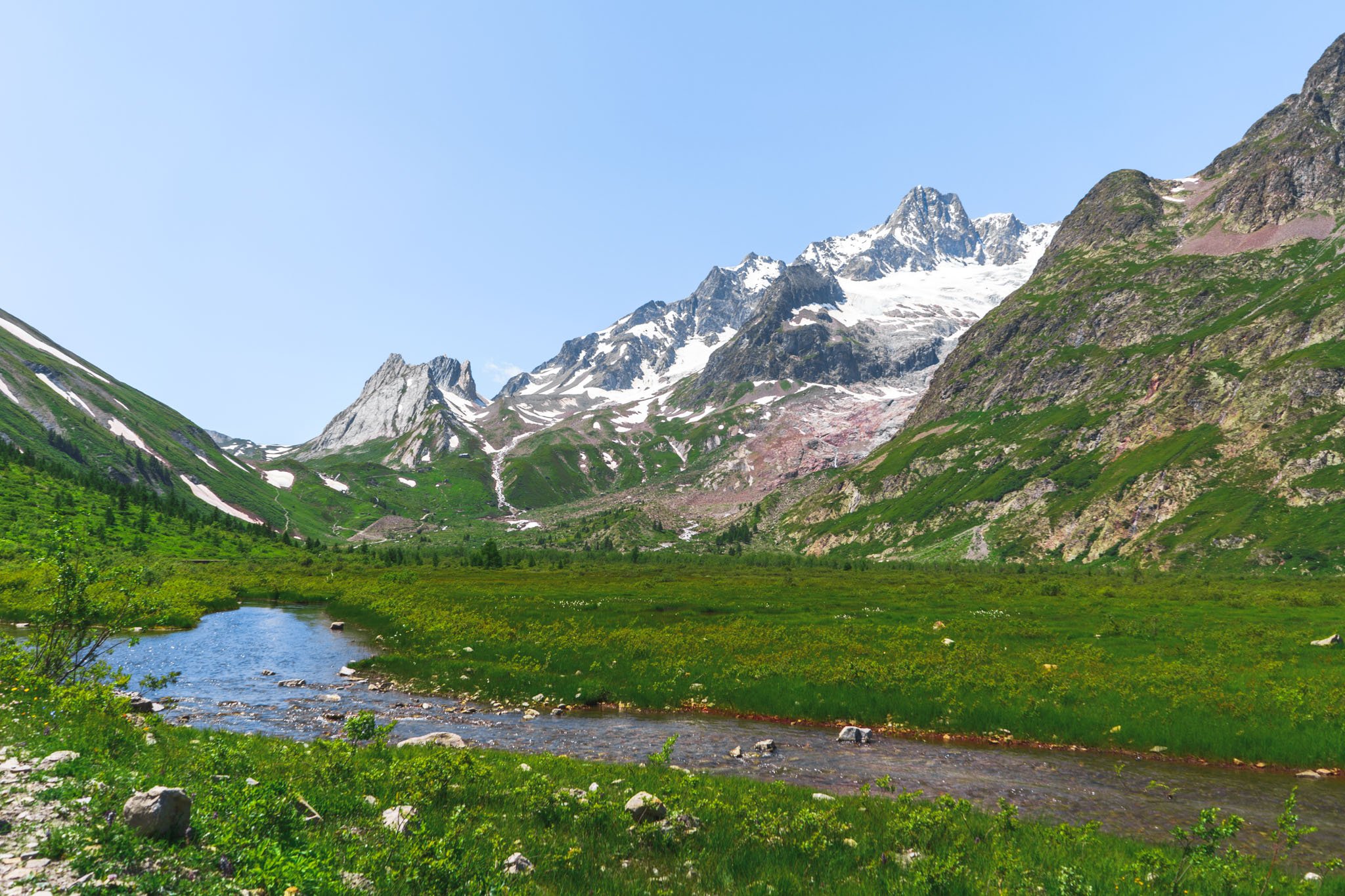
This was, hands down, the best part of TMB. Since it was late in the day, we met very few people on the trail. There were enormous glaciers to the right, one after another, with magnificent Grand Jorasses overpowering the rest of the landscape of Val Ferret.
The final climb to Grand Col Ferret was treacherous, but it all made sense when we were at the top. All that effort made it possible for us to witness this beautiful view of the Swiss and Italian Alps. Perfect sunset light, no living soul except us, lots of Ferrets running around, and immense mountains making you feel like an insignificant being in the grand scheme of things. This is, to date, my best memory from the mountains.
After appreciating the view and a quick photo session, we were on our way down to the valley to reach La Fouly, our destination for the night. This 1600m descent was endless, and we ended up reaching our hostel for the night at 22h30 at night—what a day.


Stats and route
Day 5 - La Fouly to Trient | 19KM, 1200M 🔺
After two long days of 30+ KM a day with thousands of meters of elevation gain and loss, we were happy for an uncomplicated day out in the mountains. For a change, we were hiking at a lower elevation through the swiss hamlets under the trees.
The highlight of the day for me was a stop at a family-run hut called “Alpage de Bovine”. The staff was polite, the food was fantastic, and the overall aura was comforting, a place that just made me feel at home. I hope I get to revisit it one day.
Tour Noir as seen from La Fouly under the night sky


Stats and route
Day 6 - Trient to Argentière| 17KM, 1000M 🔺
It was day 6. We traversed through the Valais canton of Switzerland and reentered France via Col de Balme. The day was gloomy with low visibility, hence the lack of pictures. It was cloudy and foggy most of the day, with occasional drizzling. We camped at a beautiful tiny campsite in a lovely French alpine hamlet. It gave us psychological relief that was were a mere few Kilometers away from Les Houches, where our car was parked. Since we did not have to cover a lot of ground today, we had a lot more time on our hands at the campsite, which allowed us to mingle with fellow backpackers.


Stats and route
Day 7 - Argentière to Les Houches| 25KM, 1700M 🔺
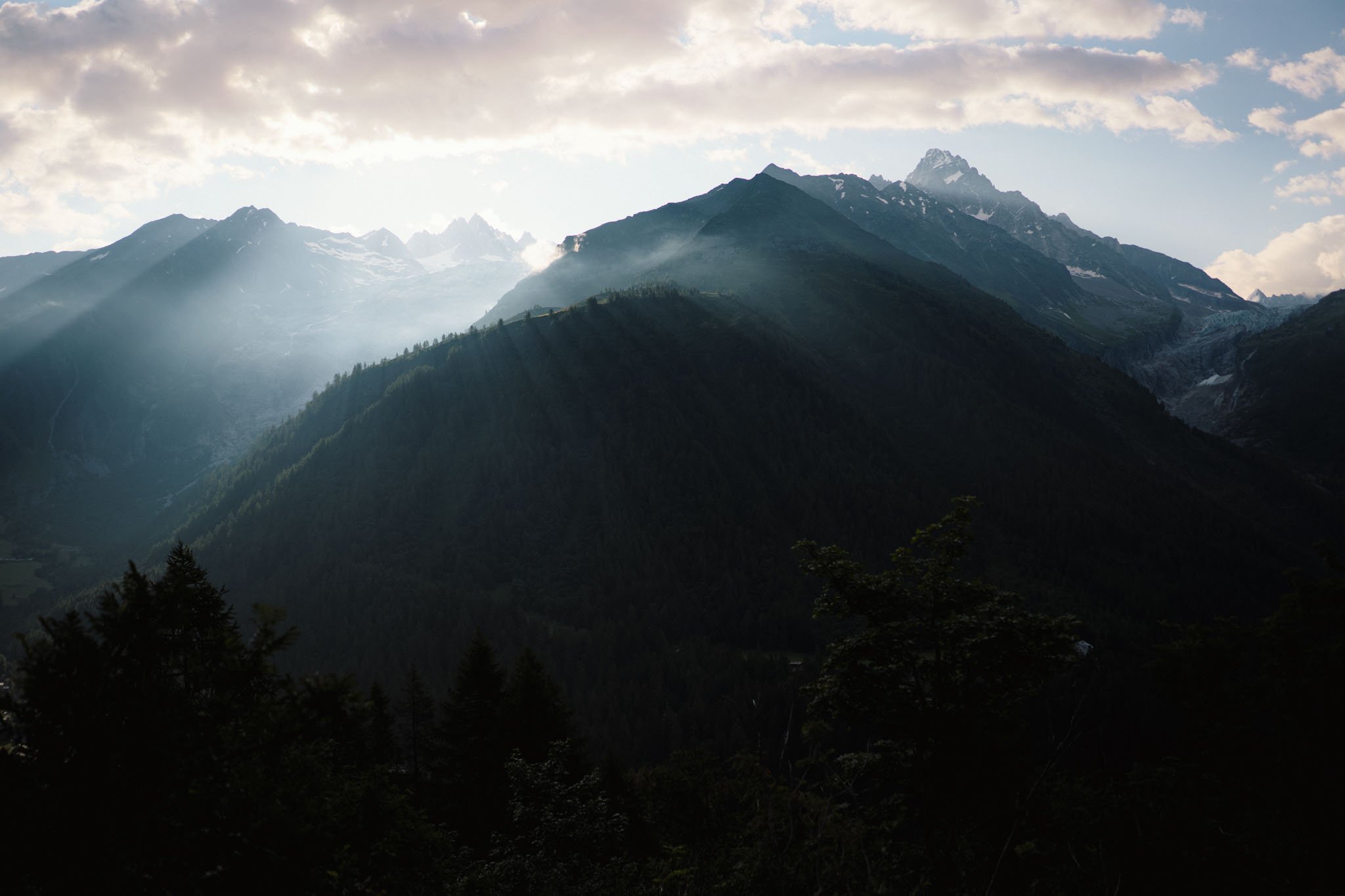
Last day of the hike, and I could not have been more enthusiastic. Contemplating the past seven days, it was all about life's necessities: food, shelter, clean clothes, a nice shower and tranquillity. It is wonderful what nature can do to you.
The morning started with a picturesque sunrise. Thanks to the low clouds on the horizon, I saw this beautiful sunshaft through the trees on a hill in front of me, which you can see in the second picture below. The trail started easy and eventually perched on the side of the mountain while we got a beautiful panoramic view of the Mont blanc and all the famous “Aiguilles”.
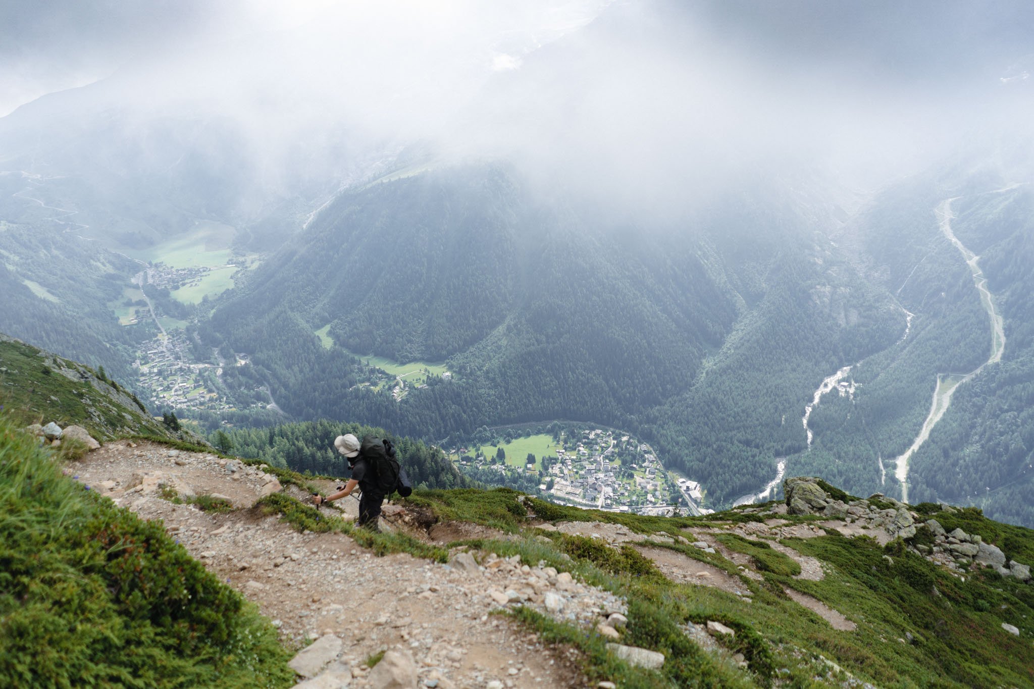
There was also a short section of ladders that can be daunting if you are uncomfortable with the heights. Some of the ladders were very exposed. Eventually, the trail leads to Le Brevent, a massive rocky peak surrounded by human-sized boulders. This section of the train had an eerie vibe to it because of the lingering fog. There was also a lot of snow around, and we sometimes wondered whether we were on the right path. This was the most technical part of the trial.
After eventually reaching the top of Le Brevent, we were swiftly on our way down before the weather took a turn for the worse. The last 1500 meters of the steep descent down to Les Houches awaited us. It was a long and painful slog because we had already been hiking consistently for the past seven days, averaging ~24km a day but finally, we made it to the finish line.


Stats and route
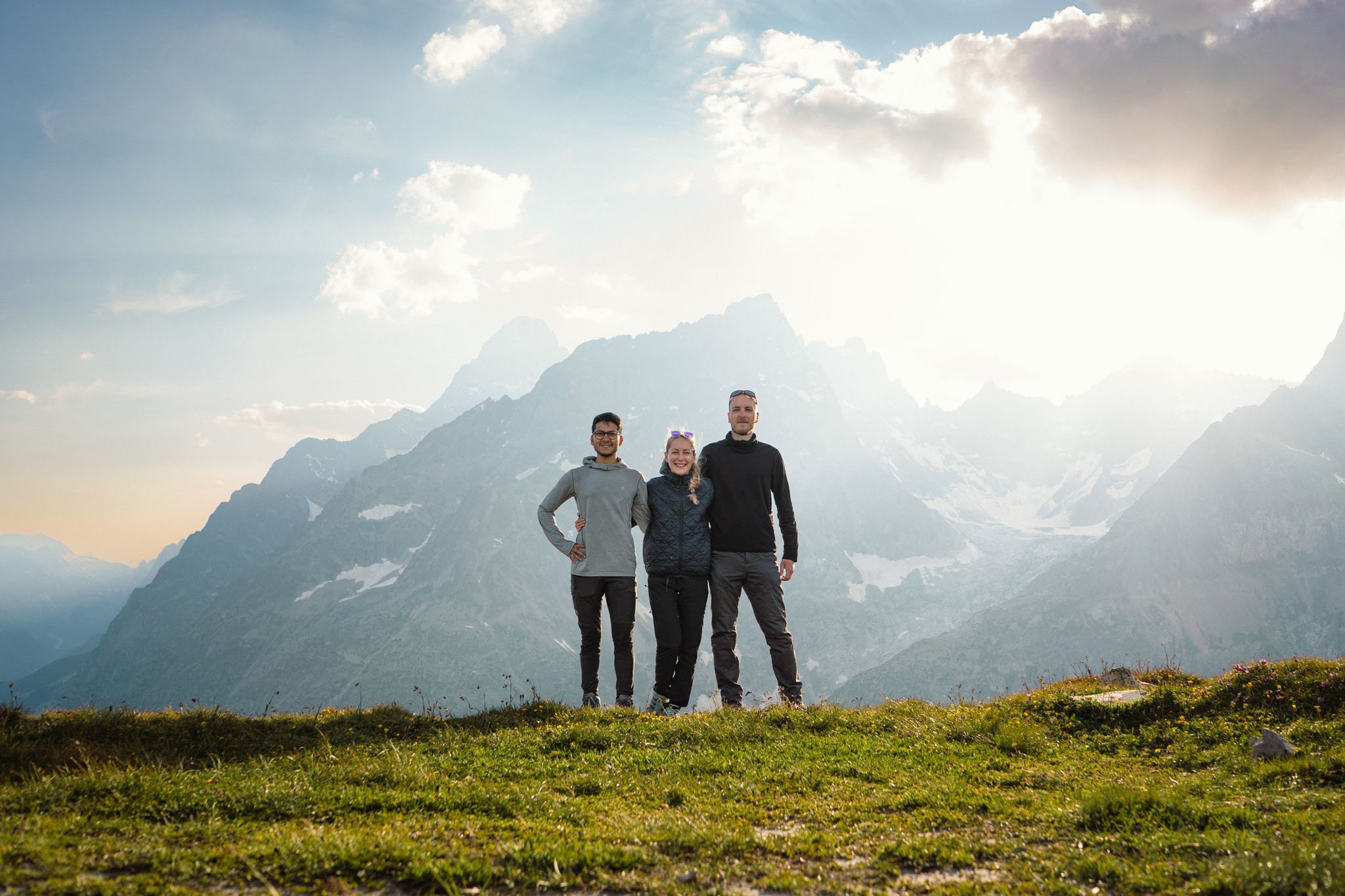
Three countries, 165 km, 10,000 M of elevation, wrapped up seven days. We were exhausted and depleted but could not have been happier or more proud of ourselves.

Very tired faces at the end of 165KM in 7 days
I can not think of any better way to spend seven days of my life other than doing this, that too, with the right people. This mountain experience has propelled me into a new world of hiking, backpacking and mountaineering. TMB was like a gateway drug that I needed to get into the outdoors. This is just the beginning of many more such adventures to come in the future.
Until next time 👋